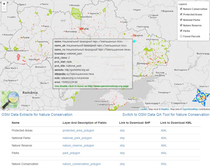
Україна поки не має надійного та публічно доступного джерела інформації та даних про природоохоронні території. Дані про межі ПЗФ зберігаються у громадах у паперовому вигляді і часто самі громади не знають, що ці документи існують, а іноді ці документи вже втрачено. Розробка відкритого кадастру природоохоронних територій була здійснена спільними зусиллями активістів громадських організацій, ГІС-фахівців, природоохоронців та практиків. В результаті були зібрані первинні дані для всіх регіонів України та розпочато процес оцифрування кордонів та імпорт даних у OpenStreetMap (OSM). Пілотна-версія сервісу для швидкого доступу до даних і валідації була запущена 2012 р. і доступна у веб-додатку – scgis.org.ua/pzf-osm.
Більше за темою меж ПЗФ:
- Відео з прогресом розробки починаючи з 2011 р
- FOSS4G 2015 – Development of the open cadastre of protected areas in Ukraine
- UNCG 2020 – Відкритий кадастр природно-заповідного фонду як інструмент збереження біорізноманіття
- Про проблему меж ПЗФ
- OSM4PAs – Poster
- Other OSM Blog Posts
- Дописи за темою #OSM
- Межі Смарагдової мережі
- ПЗФ Луганської обл.
- ПЗФ Харківської обл.
- ПЗФ Полтавської обл.

