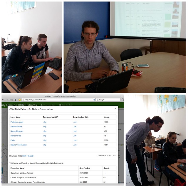
In April 04, 2017, at the Biology Faculty of the V.N. Karazin Kharkiv National University a training course was conducted on working with OpenStreetMap. The fourth-year students and teachers took part in the master class.
During the master class, participants learned how to edit the OSM data with JOSM, learned about the options for automatically generating printed maps from OSM data using online services. Have learned where to download maps for GPS-navigators created on the basis of OSM data. Acquainted with mobile navigation applications using the map and OpenStreetMap data. And learned where and how to download vector data Shape-format to work with them in desktop GIS.
Mapping the natural landscapes, we learned to use the key of tags developed by the biologist Oleg Prilutsky specially for these purposes.
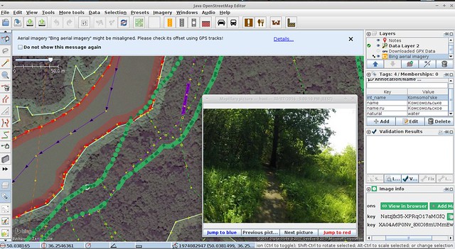
We also learned how to work with geotagged photos by directly adding photo files to JOSM and using the Mapillary web service.
The result of the master class was the layout of the map for printing, created based on data retrieved from OpenStreetMap.
Feedback and Photos from one of the participants on Facebook >>>
The useful links and tools provided during the master class:
- Online comparison service Map Compare
- Map generation services for printing:
– nakarte.tk
– inkatlas.com
– wiki.openstreetmap.org/wiki/RU:OSM_на_бумаге
- Maps for GPS-Navigators:
– Українська топографічна мапа
– Free maps for Garmin brand GPS devices
– wiki.openstreetmap.org/wiki/OSM_Map_On_Garmin
- Downloading vector layers:
– Vector data in Shape-format gis-lab.info/qa/osmshp.html
– Vector data in Shape-format data.nextgis.com/osmshp/
– Vector data in Shape-format download.geofabrik.de/europe.html
– Daily updated data “Protected Areas of Ukraine” pzf.gis.kh.ua/pzf-osm/
– Plugin QuickOSM for QGIS - РData Editor OpenStreetMap – JOSM
- Plugins for JOSM:
– Mapillary – to connect photos from the Mapillary web service
– Photoadjust – to upload local geotagged photos to a map in JOSM - Tags:
– The most common tags, wiki-section: How_to_map_a
– Tag Key “How to map Nature in OSM” - And also useful for mapping nature in OSM tags:
– Key:habitat
– Key:plant_community
– Key:taxon
– Key:species
– Key:genus
& wiki-page: Environmental_OSM