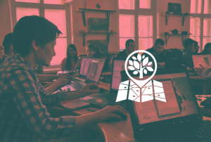
Workshop “GIS and Protected Areas”

History of the Workshop. We began holding the first regular in-person meetings in the spring of 2012, involving specialists from the national nature parks of Kharkiv Oblast (Slobozhanskyi, Homilshanski Forests, Dvorichanskyi) and researchers from the V.N. Karazin Kharkiv National University (Schools of Biology and Geography). The main topics included the delineation of protected area boundaries, setting up optimal workflows for spatial data use in biological research, and the need to launch a platform for communication and grwth. To this end, the “GIS and Protected Areas” mailing list was made. That was the beginning of SCGIS Ukraine.
In a year, in 2013, we held our first workshop, “GIS and Protected Areas.” Since then, for nine years in a row, the annual “GIS and Protected Areas” seminar has brought us together to help one another harness the power of GIS and achieve remarkable results. The online support group ensured continuous communication among participants throughout the year.
The Covid-19 pandemic forced the seminar to move online, which took away the unique atmosphere provided by its permanent host – the Slobozhanskyi National Nature Park. However, it also enabled more active use of online tools and the recording of key master classes (available on the SCGIS Ukraine YouTube channel). Since the start of the full-scale invasion, the seminar had not been held. In 2025, it was decided to resume the seminar in a hybrid format.
The aim of the workshop is to knowledge exchange in the use of geospatial technologies across various aspects of protected area management, to explore current methods and approaches for studying and conserving biodiversity and landscapes, and to enhance the professional skills of relevant specialists.
By participating in the workshop, you will gain skills in working with geospatial software, remote sensing data, and mobile and web-based data collectors to address the most pressing biological and ecological challenges. You will also become familiar with new tools and technologies for nature research and conservation. The workshop offers an opportunity to exchange best practices with colleagues.
We invite protected areas staff members, scholars and students, conservation specialists, as well as volunteers whose work involves geographic information systems and spatial data.
Possible options of participation in the workshop include: master class leader, oral presentation with slides, or attendee.
We expect each participant registering as an attendee to provide a short written information (through the registration form) about their previous experience with geographic information systems, as well as their suggestions and expectations regarding topics for master classes and presentations. This information will help identify relevant areas of collaboration between the GIS community and conservation professionals, assess the extent to which individual specialists and protected area institutions use geospatial technologies, and contribute to adjusting the program of the next workshop.
An oral presentation with slides is preserved for participants who wish to present their research findings in more detail or share practical experience in applying geospatial technologies in research and conservation. The time allocation for presenters is up to 20 minutes for the talk, followed by up to 10 minutes for questions and discussion.
A master class is suggested for participants who wish to help others learn how to apply geospatial technologies. Before the workshop, the master class leader must provide information on the required software and, if needed, the data to be used. We encourage master classes that leverage open-source and/or free software. Each master class is allocated no more than two hours.
Organizers of the 2025 workshop:
NGO “Society for Conservation GIS Ukraine”, Falz-Fein Biosphere Reserve “Askania Nova” of the National Academy of Agricultural Sciences (NAAS), Institute of Agroecology and Environmental Management of NAAS, Kuialnytskyi National Nature Park.
Organizers, co-organizers, and partners of previous workshops:
NGO “Society for Conservation GIS Ukraine”, Slobozhanskyi National Nature Park, V.N. Karazin Kharkiv National University, Krasnokutsk Village Territorial Community, Ministry of Environmental Protection and Natural Resources of Ukraine, Intetics-Geo, NGO “Ukrainian Nature Conservation Group,” Feldman Ecopark, GEOCOM, Aspectum, ECOMM Co, TVIS Company LLC, Oleg Pilat (representative of the “Open Spatial Planning” project), Ihor Raikov (director of the “INGER grad” company), National Ecological Centre of Ukraine (NECU).
Contacts:
- Webpage: https://scgis.org.ua/ua/seminar/
- E-mail: seminar@scgis.org.ua
Materials:
- Slides: https://scgis.org.ua/ua/seminar/slides/
- Proceedings: https://scgis.org.ua/ua/seminar/proceedings/
- More about the workshop on 50northspatial
Review of some participants in social media:
Dariia Borovyk, Dmytro Liashchenko

