About the problem
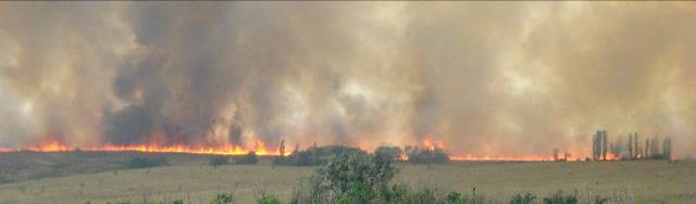
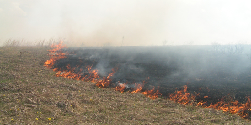
Annually in Ukraine hundreds of thousands of hectares of natural areas burn grass, reeds and forest fires. This natural disaster causes enormous, but sometimes irreparable damage to nature.
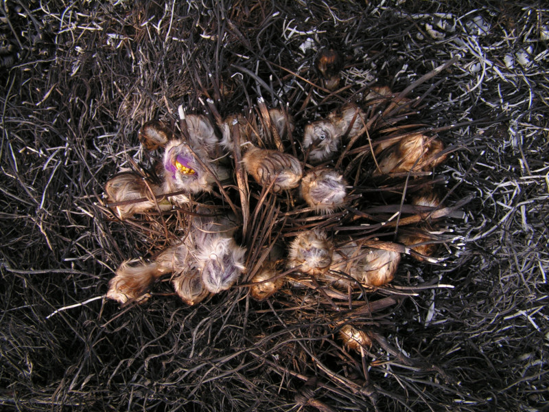
Billions of insects, animals, birds die at the fire. Falling seeds and roots of plants, located in the upper layers of the soil. Quite quickly, natural vegetation is replaced by weeds resistant to regular burnout. A huge number of animals and plants listed in the Red Data Book of Ukraine and international lists of protected species die in the fire.
Bumps humus and soil microorganisms, which leads to a decrease in soil fertility. The combustion of organic matter in the soil contributes to the rapid washing of mineral substances by rains and soil erosion of soils.
Burning of grass residues and organic matter of soils is one of the most important sources of carbon dioxide emissions associated with human economic activity.
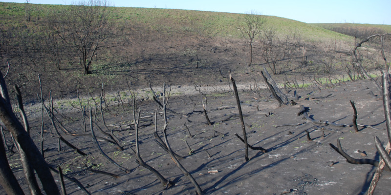
After the fire, natural ecosystems are restored for a very long time, and some of their components can not be restored without the help of people.
A lot of natural herbaceous and reed beds of Ukraine burn every year or every 2-3 years. And some territories burn up 2-3 times a year.
The cause of all natural fires in Ukraine is a person. In most cases it is a deliberate arson for various purposes or without purpose.
The problem is that the state does not keep track of the fires and assess their damage. This creates the illusion that there is no problem. And therefore, he does not make any serious steps to resolve it.
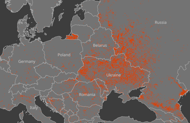
The fact that the legislative level can solve the problem of fires illustrates the map of fires in March 2014.
Project objectives
The objectives of our project are:
Estimate the real scale of the problem of natural fires in protected areas of Ukraine
To estimate dynamics of fires and to reveal regularities of appearance.
Find natural areas with herbaceous vegetation that have not burned for more than 10-20 years.
In the long term, we plan to conduct biota research in areas that have not been burned for a long time and are comparable to similar areas that burn regularly.
All research results will be openly accessible. We plan to use them as an argument to influence the formation of laws and regulations regulating the problem of arson of dry vegetation.
Method
At the moment digitization of fires by volunteers is under satellite images. Each fires found contain additional information on the date of the fire and the source of the data.
We also conduct work on the development of tools for detecting fires by satellite images using machine learning algorithms.
First of all, we analyze the protected areas of 3 regions of Ukraine: Kharkiv, Zaporozhye and Lugansk.
Results
As a result of mapping piles, we obtain vector fencing fires, in which attributes contain information on the date of the fire.
The web-map presents intermediate digitization of herbal piles across the territory of the Zaporozhye region.
How to help the project
Become a volunteer for digitizing fires for space images. We need attentive and patient people with some experience in GIS.
Withdraw from the quad-cogenerator known to you fires. If you have a kvadrokopter, then you can help shoot a burned area, it is necessary to compile an accurate photoplane and an accurate map of the burned area. If you do not know how to shoot a terrain for a photographic plan, we will teach you how to shoot a quadcopter, so that you can then build an orthophotomon on the material.
Help in the development of algorithms for automatic recognition of burned areas. If you study in Machine Learning, Data Science, Neural Networks or Computer Star. You can help preserve Ukrainian steppe ecosystems, rare species of animals and plants. In doing so, you will master a new direction for yourself – the analysis of multispectral space images.
Leave a message about the fire you know through webform: bit.ly/WildFire_Ukraine_GeoForm
For communication write to us on Facebook:
fb.com/scgisukraine
or by e-mail: info@scgis.org.ua