Нашою ГО групою створено ряд корисних веб-сервісів:
- Відкритий кадастр природно-заповідного фонду України
- Старовікові ліси Українського Полісся (разом з UNCG)
- Вивантаження даних OpenStreetMap по національним природним паркам України
- Громадський моніторинг гнізд Лелеки білого
- NP@Mapillary – щорічний конкурс фото природно-заповідного фонду України з геотегами (пауза)
- Моніторинг стану джерельної води
- Моніторинг рубок лісу (пауза)
- Моніторинг стану міських дерев
- Моніторинг пожеж у лісових ПЗФ 2022-2024 рр. (пауза)
- Моніторинг пошкоджень ланшафтів кратрами 2022-2024 рр.(пауза)
- WMS-сервіси з даними зйомки БПЛА (пауза)
- ECP Public REST Services Directory
Відкритий кадастр природно-заповідного фонду України
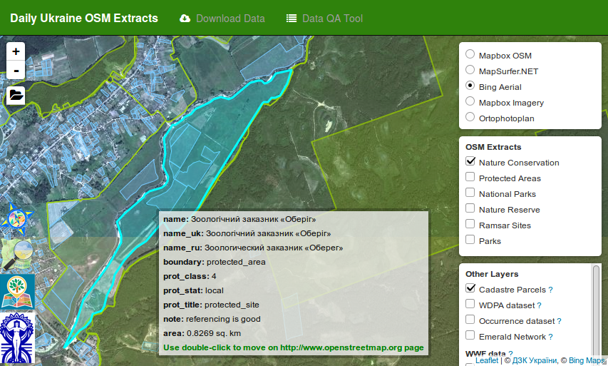 Щоденні вивантаження меж об’єктів природно-заповідного фонду України з OpenStreetMap.
Сервіс дозволяє відобразити на веб-карті межі заповідних територій поверх різних базових карт і космічних знімків. До карти також можна підключити шар “Кадастровий поділ” з Публічної кадастрової карти України, шар частоти розподілу даних по Україні з порталу Global Biodiversity Information Facility (GBIF), шари зміни лісистості за 2000-2014 роки від Global Forest Change та багато іншого. Можна завантажити свій GPS-трек і подивитися його поверх інших шарів. А головне, сервіс дозволяє завантажити межі об’єктів ПЗФ України в розповсюджених векторних форматах: SHP, KML, ESRI FileGDB.
Див. Development of the open cadastre of protected areas in Ukraine
URL: https://scgis.org.ua/app/pzf-osm/
Вивантаження даних OpenStreetMap по національним природним паркам України
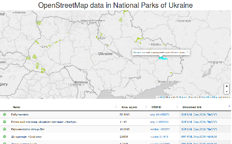 Сервіс дозволяє завантажити дані OpenStreetMap за територіями національних природних парків України і прилеглих до них територій. Дані надаються в форматах: SHP, KML, GeoJSON, ESRI FileGDB.
URL: https://scgis.org.ua/app/pzf-osm/
Громадський моніторинг гнізд Лелеки білого
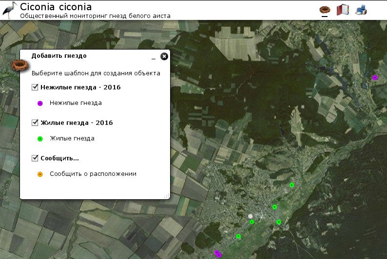 У 2013 році національний парк Слобожанський почав залучати волонтерів до дослідницьких робіт з вивчення стану популяції Білого лелеки (Ciconia Victoria). Для агрегації даних від волонтерів і було створено цей сервіс. Сервіс дозволяє внести інформацію про статус гнізда, місце розташування, ефективність гніздування, фотографію та деяку іншу інформацію. Зібрані дані щорічно передаються орнітологам.
URL: https://www.scgis.org.ua/app/stork/
NP@Mapillary 2017 – конкурс фото природно-заповідного фонду України з геотегами
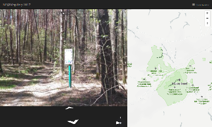 Перегляд результатів конкурсу NP@Mapillary 2017 зі збору фотографій по природно-заповідним територіям України з геотегами NP@Mapillary-2017. Інформація про конкурс на Wiki OpenStreetMap.
Обговорення конкурсу на форумі OpenStreetMap.
URL: https://scgis.org.ua/np.mapillary-2017/