If you love to travel around interesting places in Ukraine, constantly take pictures and encourage others to travel – here is a contest for you!
Two seas, steppes, forests, mountains, rivers, wetlands, and even our vast desert are all parts of our country! Some of these territories are of special conservation, scientific, aesthetic, recreational, and other value, are included in the Nature Reserve Fund (NRF) of Ukraine, and are protected by the state in order to preserve the natural diversity of landscapes, gene pool of wildlife, maintain the general ecological balance environmental monitoring.
NP@Mapillary-2019 is a competition of geotagged photos of protected areas of Ukraine, which covers all protected areas of Ukraine, and is held from June 1 to December 15, 2019, organized thanks to the Ukrainian environmental and environmental organizations SCGIS Ukraine, Ukrainian Nature Conservation Group, Slobozhansky Nature Park, Ukrainian Geographical Society and the Swedish platform for the publication of geotagged photos Mapillary!
 The aim of the competition is to increase the coverage of photos of protected areas in the Mapillary platform: national nature parks, regional landscape parks, nature reserves, botanical and zoological gardens, and monument parks; specification of boundaries of territories, improvement of open data, involvement of OSM-visitors and tourist attraction of protected areas; walks in interesting places, as well as analysis of changes in different seasons, because the competition covers 3 seasons – summer, autumn, and winter!
The protected areas fund of Ukraine (as of January 1, 2019) includes 8396 territories and objects with an actual area of ??3.99 million hectares within the territory of Ukraine and 402 500 hectares within the Black Sea, which is 6.1% of the national territory. These include, in particular, 19 nature and 4 biosphere reserves, 49 national nature parks, 45 regional landscape parks, 3078 nature monuments, 2729 nature reserves, 616 botanical, zoological gardens, arboretums and parks and gardens, 793 nature reserves tracts.
In addition, the territory of protected areas is constantly expanding. In 2019 alone, it increased by almost 80,000 hectares (approximately 0.13% of the country’s area).
In recent years, 271 Ukrainian sites have been included in the Emerald Network of Europe, 14 new sites of virgin forests have been included in the UNESCO World Natural Heritage Site, and 6 wetlands have been added to wetlands of international importance.
The competition is being held for the fifth time, and every year the interest of the participants, the number of photos and the coverage of the territories increase. The most active participants who took the most photos received prizes in each competition – smartphones, action cameras, lights, external batteries, flashcards, T-shirts, and other promotional gifts.
Methods
So let’s talk about survey methods and rules of engagement!
A special map and statistics have been created for the NP@Mapillary-2019 Contest, where you can see the borders of the protected areas where you need to take pictures and follow your achievements on the way to victory!
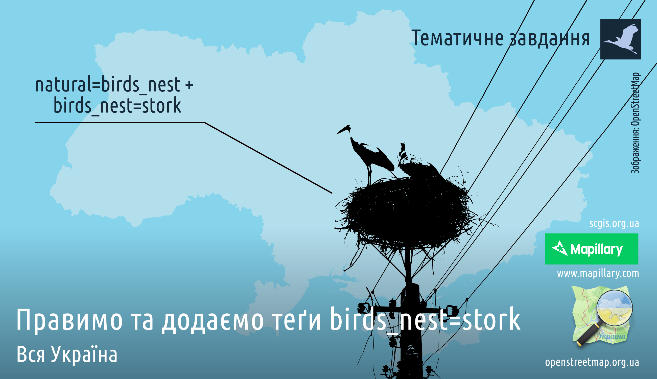
Take photos of roads, trails, clearings, quarterly columns, pillars of logging, security and restrictive signs, places of felling and new plantings, nesting places of birds, and trails of wild animals, and any other places that can be useful for tourists, tourists, nature conservation and environmentalists.
To participate in the competition, you need to do some simple steps:
- participate
- share this post on your FB page
- take photos within the territories of the assets of the PFP of Ukraine
- upload your photos to Mapillary
- follow NP@Mapillary-2019 statistics
You can take photos using smartphones, tablets, action cameras, regular cameras, and other devices with a camera and GPS module. Anyone can do it.
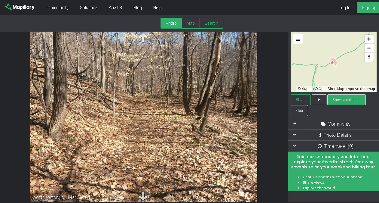
Mapillary is a huge free open-source photo hosting platform with the main task of capturing, uploading, recognizing photo data by artificial intelligence and analyzing photos and photospheres that are captured and uploaded by participants. Each photo has the exact location. This allows photos to be merged into photo sequences.
The process is quite simple
If you are using a mobile device (smartphone or tablet):
Install the Mapillary app for Android or iOS
- sign up for an account
- open the Mapillary app and GPS
- turn the device into landscape orientation
- point the camera forward
- click the Capture button
- start walking or driving
- press the Stop button to stop taking pictures
- click Upload and upload the footage
The app will automatically take photos every few meters as you move, so try to move smoothly and keep your device pointing in one direction.
Upload your photos via WI-FI when you return home (or other places with internet access).
If you use an action camera with built-in GPS:
- activate GPS, Time-Lapse mode, and shooting rate 1-3 frames per second
- start shooting while walking, cycling, or driving
- upload your photos through mapillary.com/uploader or the Desktop Uploader
If you are using an action camera or camera without GPS and have a smartphone with GPS:
- make sure that the time of the action camera (camera) coincides with the time on the smartphone
- start recording GPS track with your smartphone (OSMAnd or OSMTracker recommended (Android only))
- activate Time-Lapse mode and shooting rate 1-3 frames per second
- start shooting while walking, cycling, or driving
- stop taking photos and recording the track
- upload photos and track to your PC
- sync your photos and track with the JOSM app
- upload your photos through mapillary.com/uploader or the Desktop Uploader
In addition to using cameras, participants can use DVRs and camcorders. The Mapillary platform allows you to download videos and gpx tracks using the site or mapillary_tools python scripts.
The Contest will give you a great opportunity to develop your skills in dynamic photography, the places already investigated will encourage you to visit new territories, and planning new routes will improve your awareness of orientation. Getting acquainted with Open Street Map, Mapillary, artificial intelligence, mapillary_tools script and various convenient methods of uploading photos will develop you in general.
Encourage others to participate! Share your results on social media! Join interest teams and explore new places together!
NP@Mapillary-2019 – it’s fun!
Source: NP@Mapillary-2019 — geotagged photo contest (by Aleksey Lyulyuk)
Find more on: