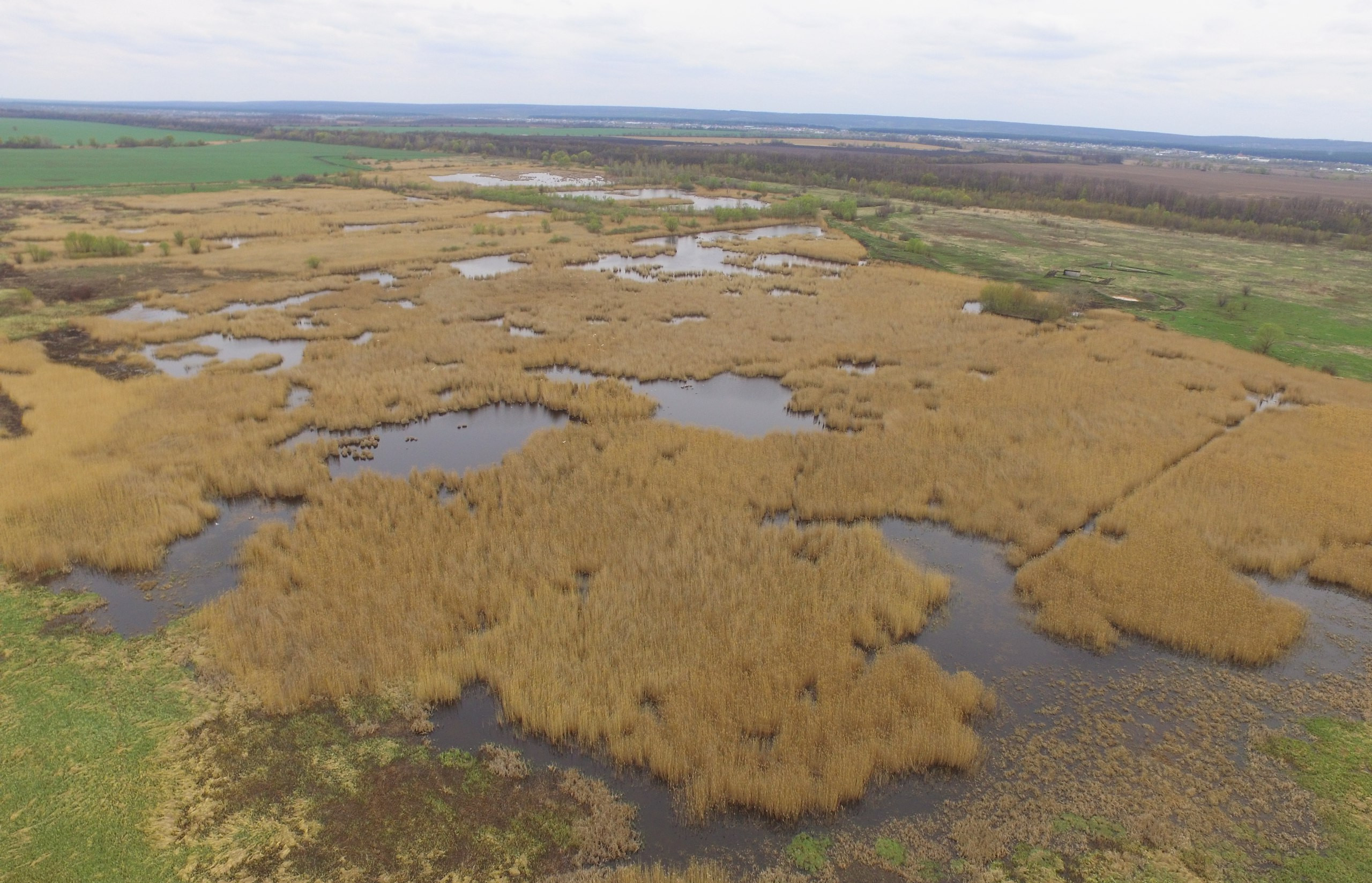
There is a problem that the protected areas do not have the basic cartographic material of high detail, and the cartographic material reflecting the actual state of the territory, there is also no cartography and actual information about the status of other areas important for the protection of specific species and natural communities. To compensate for this gap, we began work on surveying areas of environmental importance using unmanned aerial vehicles (UAVs).
As a result of filming, we get a photo-plan of high-resolution terrain and a digital relief model, perspective photographs of the terrain and video-plots.
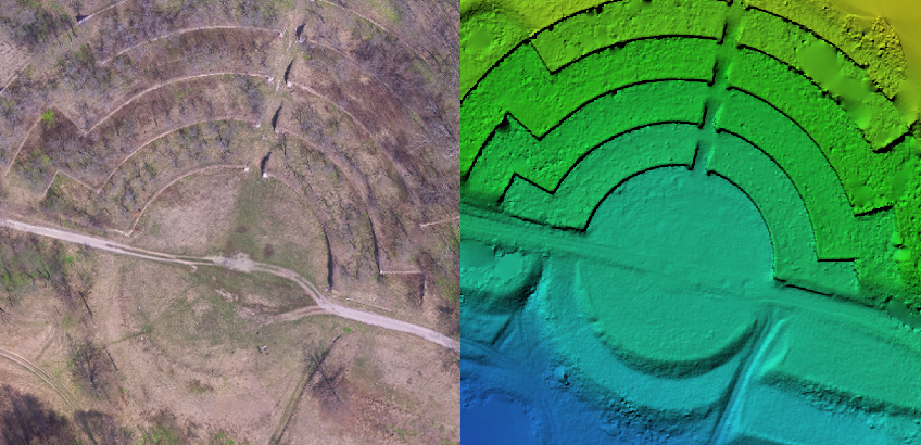
Architectural monument “Singing terraces” (Krasnokutsky district, Kharkov region, Ukraine)
Shooting areas with the help of the UAV, allows assessment of the colonies of birds nesting in the wetlands. On the example of a great white egret (Ardea alba L.1758) – species of fauna which are subject to strict protection in accordance with Annex II of the Convention on the Conservation of Wild Flora and Fauna and Natural Habitats in Europe (Bern, 19.09.1979).
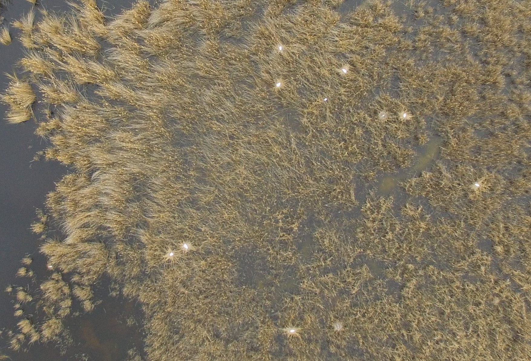
Fragment of the colony of the Great Egret (Ardea alba) in the vicinity of the city of Kharkov, 17/04/2017.
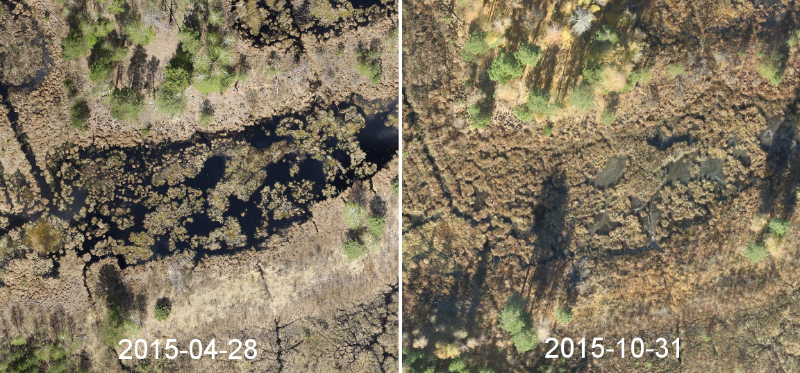
In addition, we plan to conduct periodic surveys of some areas to monitor the state of natural objects for a long time.
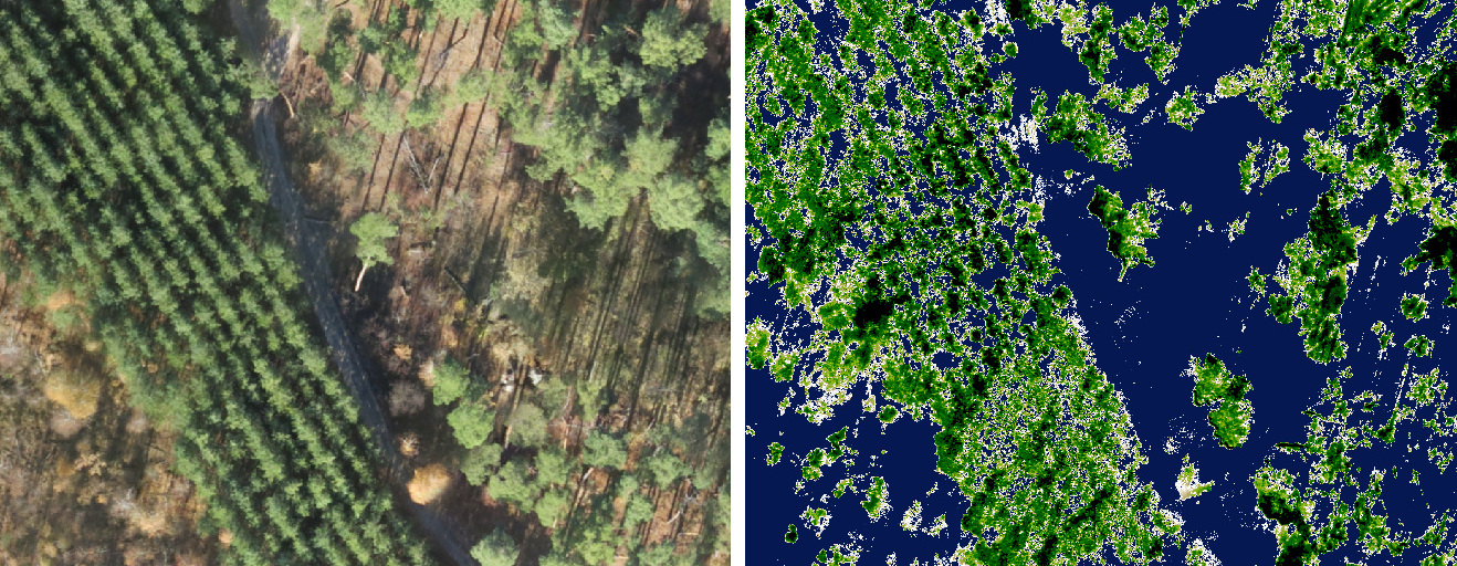
At the moment we are shooting mainly with cameras taking pictures in the visible spectrum, but we hope that in the near future we will have a camera that allows us to shoot in the infrared spectrum. This will allow for a more detailed study of plant communities through vegetative indices, to study the vegetative activity of various herbaceous ecosystems, the state of forest tracts and much more.
Also, for a better survey of the terrain and accurate positioning of the resulting photographic plans and digital terrain models, we use a geodetic GPS receivers with RTK corrections.
Filming is conducted directly by our activists and commercial companies such as Drone.ua, SenceFly & Intetics Geo are involved, which often help our environmental initiative on a charitable basis.
An example of data obtained during the survey in the territory of the national natural park “Slobozhansky”:
Esri Story Map about our Areas of Interest for UAV-monitoring in Uktaine: https://arcg.is/0C5iWD
Web-maps with materials for shooting in other territories and addresses of WMS-services with data for connecting them to desktop GIS are located at https://scgis.org.ua/services/
News on our events in the UAV category: https://scgis.org.ua/drone/